
Follow a Miami Township Street
A Miami Township street directory search is a property-record sequence, not a roster of everyone at an address. Start with the Montgomery County Auditor address search. Its core-street approach can return the parcels associated with a street name. Open the relevant parcel and retain its parcel ID, legal description, current tax owner, separate owner mailing fields, tax district, and conveyance or deed reference when one appears. The next steps test the property trail rather than treating any one field as proof of present occupancy.
- Search the address with the street’s core name. Add the number when one parcel is already known, then save the selected parcel ID and legal description.
- Open the parcel in the Auditor GIS or search the street there. Use map identify, plat layers, and the Address Number Grid when the address format is uncertain.
- Carry the legal description and current owner into the Recorder’s RISS index. Its STR route supplies a Miami Township property choice for deed research.
- Read the newest deed, then use the prior party and the same legal description to move backward. County indexes and the Archives provide the older-record route.
- For an individual voter question, use Ohio Voter Lookup by name and county. A street choice only narrows same-name results; it does not produce a public street roster.
Past household questions need a separate source type. Once an era and address are established, the Dayton Room, HOBITS citations, and a confirmed historical directory volume can add context without turning owner fields into a household claim.
Search Miami Township Streets by Address
The Auditor’s property form is the practical first stop for street-by-street work. Number is optional and Street Name is the main field. The County tells users not to enter a cardinal direction or suffix, so a core street name is the better starting format. An asterisk works as a wildcard. Results can then be adjusted by tax year, sorting, and results-per-page controls. An owner search is separate and uses a name in Last First order. Parcel ID searches accept all or part of the identifier, without hyphens.
| Auditor field | How the form handles it | Street-directory use |
|---|---|---|
| Number | Optional | Narrows a search to a known parcel. |
| Street Name | Core name, no direction or suffix; * wildcard | Finds parcels along a Miami Township street. |
| Tax Year | Dropdown visible from 1980 through 2099 | Filters assessment views, not every historic record type. |
| Owner Name | Last First format with wildcard examples | Checks a tax-owner record after a parcel is identified. |
| Parcel ID | Full or partial ID, no hyphens | Reconnects an address result to a durable property key. |
The Auditor address-search screen shows the number-and-street entry route and its result controls.
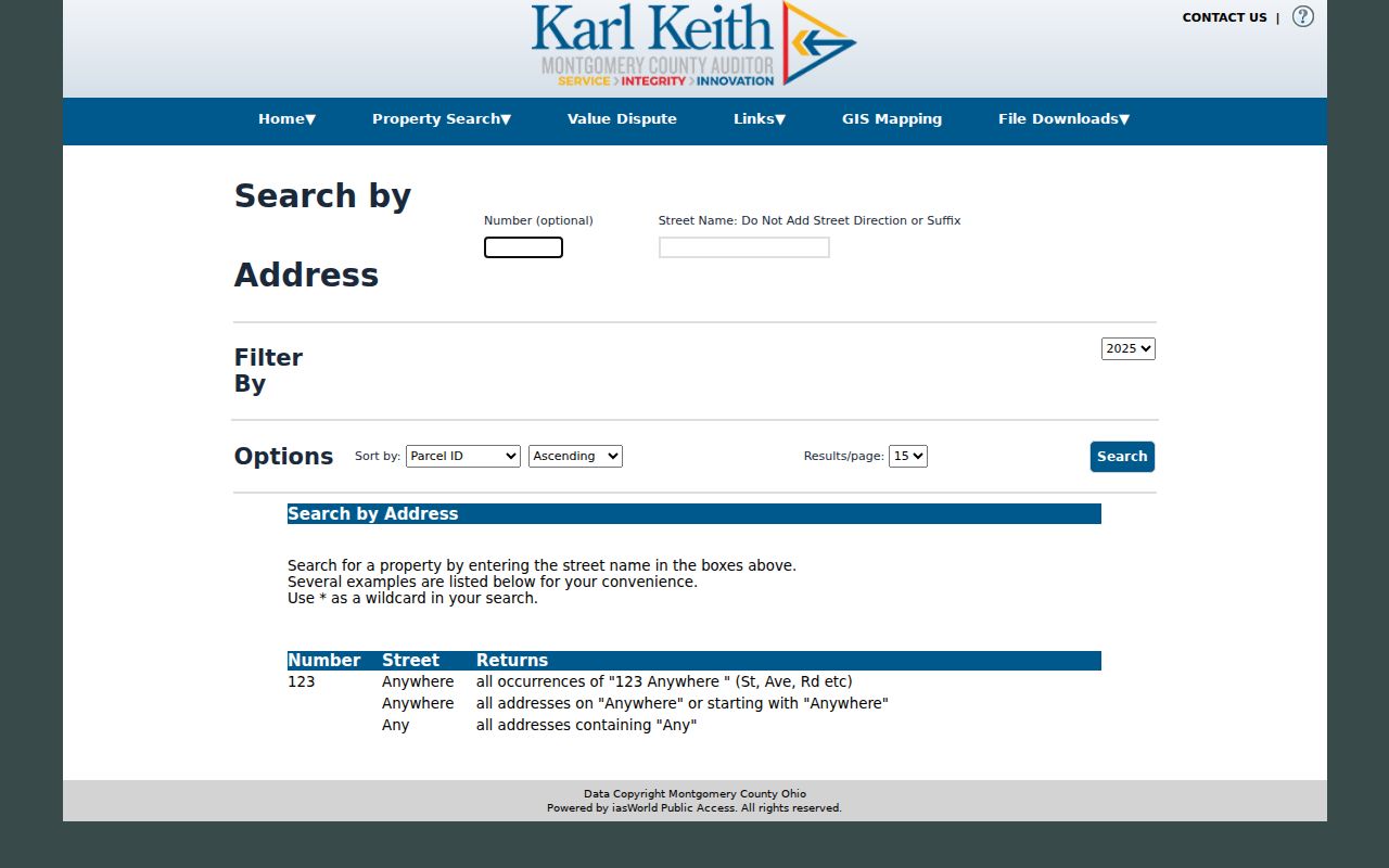
Use the screen as a field guide, then keep the selected parcel’s legal description with the search notes. A tax-year menu is not proof that an early deed image exists online.
Map Miami Township Street Parcels
The Montgomery County Auditor Interactive GIS bridges an address result to map context. It supports Address, Street, and Intersection search, map identify, report export, Document Viewer, measurements, and point, line, polygon, or rectangle selection. Its Parcel Buffer tool offers 100, 200, 250, 300, and 500-foot choices. Those tools locate nearby parcels and recorded map context. They do not identify every person who may be associated with a location.
For a street change or a confusing postal label, inspect the recorded-plats, Address Number Grid, Historical Lines, annexation, corporation-boundary, Section-Town-Range, and right-of-way layers. The map carries an accuracy and no-warranty notice. A deed, plat, or legal-boundary decision still belongs with the custodian record, not the map display alone.
The Auditor GIS parcel-service metadata documents the public parcel fields behind the map.
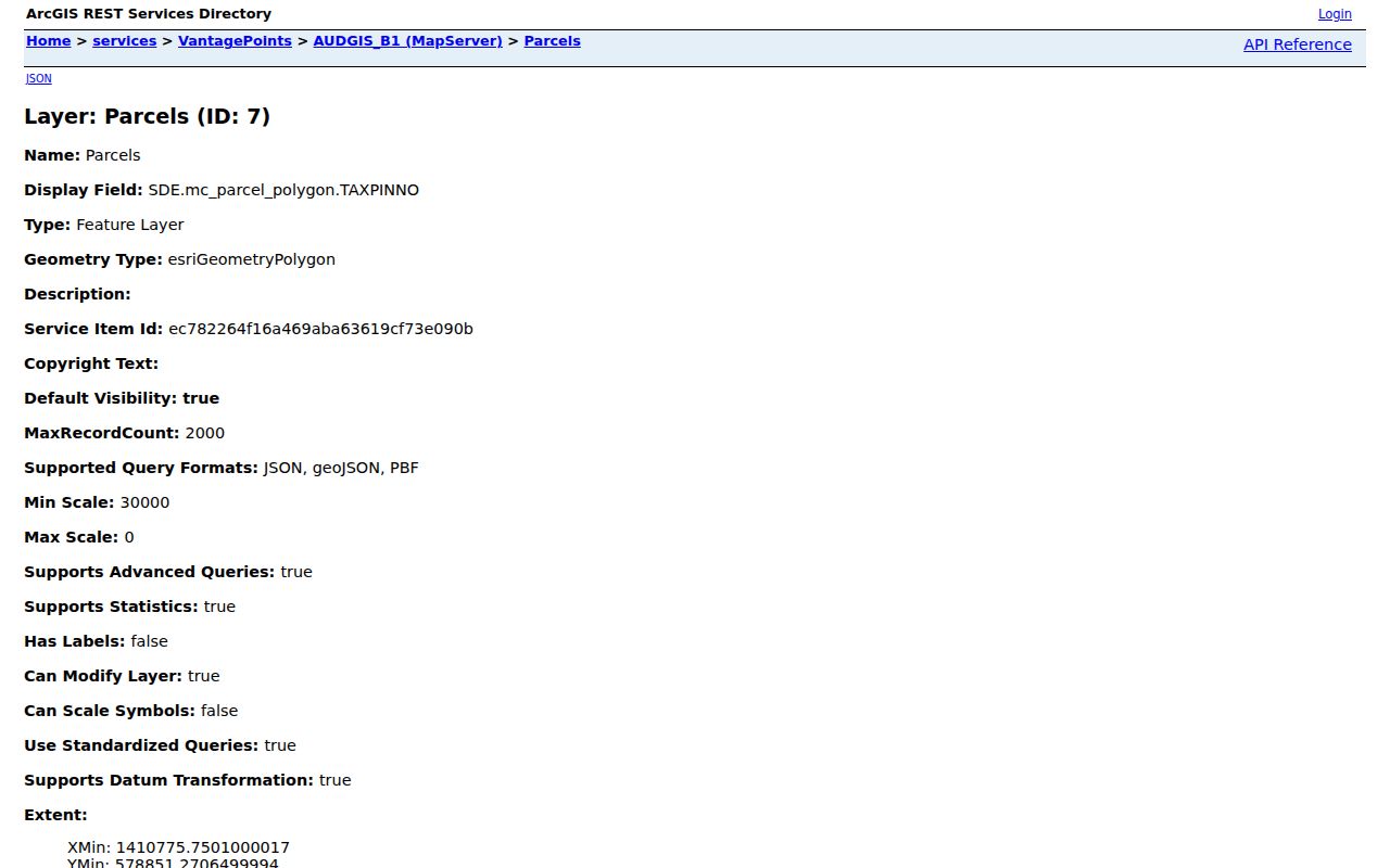
The field list separates parcel location and legal data from owner mailing information, an important distinction when comparing properties along a street.
Use Miami Township’s RISS STR Route
RISS is the Recorder’s online index for recorded property documents. Guest access follows its disclaimer, and the system offers name, document type, municipality, subdivision, STR, instrument, book/page, fiche, pre-1980, date, and other browse modes. The Miami Township quirk is important: the By Municipality selector did not expose Miami Township during inspection, while the STR Properties list does. For Township deed work, select STR, set Properties to MIAMI TOWNSHIP, choose the required index type, and refine with Section, Township, Range, party name, or date when known.
A RISS result can show type, file date, match, parties, legal description, file number, reference, and image links. Deeds begin in 1805, but the County’s property guide and Recorder material document online deed images from 1980 forward. That divide means an earlier legal-description search can lead to an in-person Recorder or Archives index instead of a missing web image.
The RISS STR legal-description form displays the Township-specific property selection.
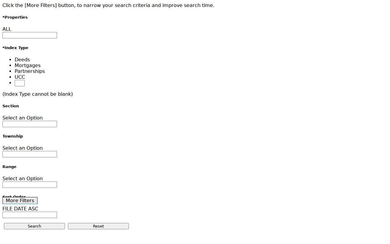
This route keeps the search tied to the legal place of the parcel, which is more durable than a modern mailing-city label.
Read Miami Township Address Fields
A street directory can look more certain than the underlying fields allow. The parcel schema separately records the situs, or physical parcel location, and an owner mailing address. It also carries a legal description, jurisdiction, acreage, land-use and class fields, values, sale data, and parcel ID. Miami Township land may use Dayton, Miamisburg, Franklin, Germantown, Moraine, or Springboro as a postal identity. The City of Miamisburg is located within the Township but remains a separate city, so a mailing city cannot settle jurisdiction.
- Parcel
- A county property unit with an identifier that connects tax, map, and transfer records.
- Situs address
- The physical location of that parcel, not necessarily an owner’s mailing location.
- Legal description
- The lot, subdivision, or Section-Town-Range description used to follow land through deeds and tract indexes.
- Plat
- A recorded map that can show lots, streets, and subdivision layout.
- Criss-cross directory
- A reverse address listing, if a library confirms a volume and its geographic coverage.
Use the legal description whenever a street label appears to have changed or an older record does not recognize a current number. The County does not document a verified Township-wide renumbering year.
Miami Township Street Directory Records
Each address record answers a different question. The Auditor and GIS establish the parcel and its current tax record. RISS and older Recorder indexes document recorded transfers. Township zoning files can connect a property to an application or project, while the Archives preserve earlier tax and permit material. None of these records creates a verified list of the people presently living on a street.
| Address-keyed record | Custodian | What it contributes | Access channel |
|---|---|---|---|
| Parcel and tax record | Montgomery County Auditor | Situs, owner and mailing fields, legal description, tax and sale data | Free address, owner, parcel, and advanced search routes |
| GIS parcel context | Auditor GIS | Street map, parcel attributes, plats, history layers, nearby parcels | Address, street, map selection, and 100–500-foot buffers |
| Recorded deed index | Montgomery County Recorder | Parties, document type, file date, legal description, reference, image | RISS guest search; Recorder counter and older indexes |
| Historic tax and permit groups | Records Center & Archives | Ownership and value chronology, construction or alteration timing | Research area and targeted request |
| Zoning-certificate file | Miami Township Community Development | Applicant or owner, address or parcel, project and site-plan details | Application channel or targeted public-record request |
Note: Retain the parcel ID and legal description in every request so a custodian can identify the correct property file.
Voter Limits on Miami Township Streets
Ohio Voter Lookup is an individual confirmation tool. It requires first name, last name, and county, then can offer a street-name choice to separate multiple matches. It checks registration and shows precinct or polling-location information, but it is not a searchable street list. The public form does not request date of birth. A nonmatch can be taken to the Montgomery County Board of Elections rather than treated as proof that a person has no local connection.
R.C. 3503.26 permits public inspection of precinct registration lists at the Board office, with names and addresses copied in the office during open hours, subject to the statute’s timing and disruption provisions. R.C. 3503.13 also protects sensitive identifiers and confidential program information. The Board of Elections is at 451 W. Third Street in Dayton; its polling-place tool is geographic, not a person search. This distinction keeps a Miami Township street search within the access channel the law actually provides.
Miami Township Zoning by Address
Township zoning certificates are address-based property records. The general application requests an address or parcel ID, owner and applicant information, project type and use, dimensions, site details, and a plan. Submitted material is retained as a public record on the property. The Township’s CitizenServe route advertises permit, code-enforcement, report, and permit-search functions, but registration is required to apply, pay, or view status and no anonymous result fields were verified. For a specific address, use the application channel or request the property record from Community Development.
The Miami Township zoning-application hub is the official starting point for these address records.
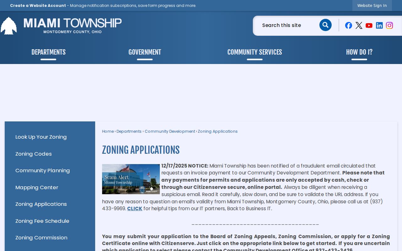
Township zoning began after a voter-approved local resolution in 1972. Earlier zoning was County administered, so older property research may belong in County planning files or the Archives.
Street History in Miami Township
Older street research should proceed from the legal description, not from the assumption that today’s number or postal city appeared on each historic document. The Archives lists deed name indexes for 1805–1928 and a tract or legal-description index for 1805–1986. Historical real-estate tax lists cover 1803–1983, while building-regulation permits run 1947–2002 and permit cards run 1947–1964. These series can establish land and improvement chronology when the modern property page reaches its limits.
The County’s own house-history method is current Auditor owner, legal description, then Recorder grantor-grantee alphabetical index or tract index. GIS layers for Historical Lines, Address Number Grid, recorded plats, and annexations can help reconcile a mismatch. No authoritative source identifies a Township-wide street-renumbering or renaming year. That gap is a reason to compare legal descriptions, not a reason to assign a date to a change.
Miami Township Street Directory Limits
Property fields show tax ownership, a correspondence address, and the land record. They do not prove a current household. GIS buffers show nearby parcels, not everyone living near them. Public street sources do not supply utility-account information, delivery records, motor-vehicle personal information, every household member, or protected voter information. Owner-occupancy and homestead indicators are tax-program fields, not a household roster.
Lawful use. Miami Township street and property records support personal, lawful research and property history. R.C. 2903.211 makes a pattern of conduct that causes fear or mental distress, including certain electronic posting, a stalking offense; never use records to stalk, harass, or harm another person.
For a disputed parcel field or a legal-boundary question, ask the Auditor, Recorder, GIS custodian, or Community Development office for the source record rather than relying on a compiled result.
FAN Alerts for Miami Township
The Recorder’s free Fraud Alert Notification service is a property-safety tool for a registered owner. FAN sends a mail, email, or text notice when a document is recorded and provides an instrument number for review in RISS. It is an alert, not a block on recording. A suspicious filing should be compared with the RISS instrument and reported promptly to the Recorder. The County’s 2025 Recorder material described growth in the service and a regional deed-fraud referral after a notice surfaced suspicious quitclaim activity.
Use a direct Recorder contact for document questions. An unsolicited request for payment should be checked against the Recorder’s published fee and contact information before any response.