
Miami Township ZIP Identity Table
Miami Township has eight documented postal identities in Township agendas and other official materials. They are delivery labels tied to particular examples, not proof that every address in a listed ZIP lies in the Township. The City of Miamisburg is physically within Miami Township but is a separate city. For that reason, a ZIP code directory must keep postal identity, parcel jurisdiction, and municipal status apart.
| ZIP | Areas covered | Post office / postal identity | Notes |
|---|---|---|---|
| 45005 | Township-linked Crains Run Road example | Franklin | Confirm the exact delivery address with USPS. |
| 45066 | Miami Township portion recognized with a Springboro postal identity | Springboro | ZIP and municipal or township boundaries differ. |
| 45327 | Township-linked Jamaica Road example | Germantown | Not every 45327 address is necessarily in the Township. |
| 45342 | Government Center and South Union Road examples | Miamisburg | Common Township office identity; Miamisburg remains a separate city. |
| 45439 | Township trustee-candidate address example | Moraine / Dayton | An address example, not a boundary rule. |
| 45449 | Blossom Park example | Dayton / West Carrollton | Confirm the individual address. |
| 45458 | Kingsridge Drive example | Dayton | Confirm the individual address. |
| 45459 | Miamisburg-Centerville Road example | Dayton / Washington Township | Confirm the individual address. |
The table records the postal identities actually evidenced for Township addresses. It does not invent a universal postal boundary, a ZIP realignment date, or a special post-office classification that research did not verify. Use a full street address, including a unit where needed, before treating any row as a location result.
Miami Township USPS ZIP Checks
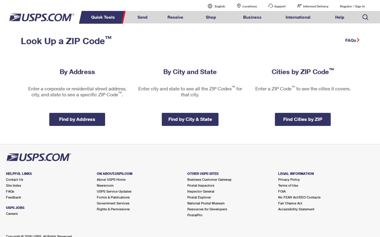
USPS ZIP Code Lookup is the first validation channel for a delivery address. It offers three different search modes. By Address accepts an optional company, street, optional apartment or suite, city, state, and ZIP. By City and State accepts city and state. Cities by ZIP accepts the ZIP alone. Each mode uses a Find control. The result verifies postal geography, not a named person’s mail receipt or governmental jurisdiction.
| USPS mode | Fields documented on the form |
|---|---|
| By Address | Company optional, Street, Apt/Suite optional, City, State, ZIP |
| By City and State | City and State |
| Cities by ZIP | ZIP |
The USPS ZIP Code Lookup displays those address, city-state, and ZIP search modes.
A street and unit are more dependable than a ZIP alone when the same postal identity covers several nearby places.
Miami Township ZIP Geography
A Miami Township ZIP can carry the name Miamisburg, Dayton, Franklin, Germantown, Moraine, or Springboro. That variation reflects a complicated delivery landscape, not an error by itself. Miami Township is an unincorporated limited-home-rule township in south-central Montgomery County. Miamisburg lies within the Township’s geography while remaining its own city. The government center’s Miamisburg postal address does not turn the Township into the City of Miamisburg.
The Township’s mixed geography helps explain the record labels. Rural roads, subdivisions, commercial corridors, city records, and county section-township-range descriptions can all arise in the same research path. When an Auditor parcel shows a jurisdiction field and legal description, those are stronger geographic clues than a casual mailing-city label. This is why the ZIP code directory uses a postal-identity table instead of calling ZIPs Township lines.
Postal comparison. A USPS result validates mail geography. It does not establish municipal jurisdiction, Township status, or that a named person receives mail at the address.
Search Miami Township by ZIP
No verified one-click ZIP-wide Miami Township filter exists in the County Auditor property portal or public GIS viewer. The property portal’s advanced-search ZIP filter was not verified, and a ZIP displayed on a result does not prove the search can filter Township properties by ZIP. The documented GIS entry points are address, street, intersection, and map selection. Treat that gap as a limit, not as permission to promise a ZIP-wide resident result.
- Confirm the full delivery address through USPS, using a unit number where it applies. Record the postal city and ZIP exactly as returned.
- Search the Montgomery County Auditor by address. Its documented address fields are Number and Street Name; omit a cardinal direction or suffix, and try spelling variants where needed.
- Open the matching parcel and compare the situs, owner mailing field, jurisdiction, parcel ID, and legal description. The mailing field may differ from the physical parcel.
- Use the County GIS viewer for map selection and address, street, or intersection work. Its public layers include address-number grid, historical lines, corporation boundaries, annexations, recorded plats, and Section-Town-Range.
- Once a ZIP narrows the area to a street or parcel, use the Miami Township street directory for the address-based record trail.
The process deliberately moves from postal data to parcel evidence. It avoids claiming that a property owner or mailing field names every person at a location, and it preserves the distinction between a delivery identity and a land record.
The Auditor’s transfer search supplies another parcel check. Its documented entry points are Year and Conveyance Number, Parcel ID, or optional street number and street name. A parcel-ID query can use all or part of the identifier, and the County’s published example begins A01 00107 0001. That example is not a universal format for every parcel. Keep the actual identifier returned for the address instead of forcing a ZIP code or a guessed parcel pattern into the search.
When the current parcel leads to a recorded deed or other land document, retain its legal description and conveyance reference. Miami Township has a local RISS quirk: the Recorder’s STR and legal-description form includes a MIAMI TOWNSHIP property option, while its By Municipality selector did not expose Miami Township during inspection. That matters for a property trail, but it still does not create a ZIP-wide Township filter.
Miami Township ZIP Jurisdiction
Government jurisdiction follows the relevant office’s territory and the specific record, not the city word appearing in a ZIP result. Miamisburg Municipal Court has territorial jurisdiction that includes Miami Township, Miamisburg, Germantown, West Carrollton, and German Township. Its court reach is an example of why a geographic question should be verified through the appropriate jurisdiction record rather than inferred from a postal label.
Miamisburg Municipal Court’s jurisdiction information lists the jurisdictions served by the court.
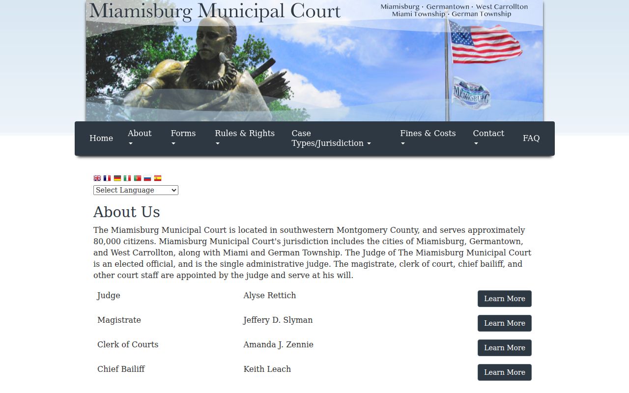
The court listing does not map ZIP lines, but it shows that an official jurisdiction can include Miami Township alongside separately named places.
For zoning and land-use history, jurisdiction matters as well. Township materials state that Township zoning began under a voter-approved resolution in 1972; before that, county zoning applied. That change is a record-jurisdiction detail, not evidence of a ZIP boundary change.
Miami Township ZIP Address Terms
Several address terms answer different questions during a ZIP code search. Keeping them apart prevents a postal result from being carried too far into property or court research. The Census Bureau’s ZCTA is particularly easy to mistake for a boundary, even though it approximates USPS service geography from Census blocks and is not a legal city or township line.
- ZIP code
- A USPS delivery-routing code. It helps validate mail geography but is not a Township boundary.
- ZIP+4
- An added four digits that further identify a delivery segment. It is more specific for mail routing, not a parcel jurisdiction.
- ZCTA
- A Census approximation of ZIP-service geography created from Census blocks, not a legal municipal or township boundary.
- Situs address
- The physical parcel location shown in Auditor and GIS records.
- Mailing address
- The correspondence address held for an owner. It can differ from the situs.
- Legal description
- The lot, subdivision, or section-township-range wording that connects land records even when street labels change.
Miami Township ZIP Record Limits
A ZIP code directory can help organize address research, but it cannot produce a Township-wide roster of people. Ohio Voter Lookup is an individual confirmation tool that requires first name, last name, and county, then may offer a street choice for multiple matches. It is not an open ZIP-by-ZIP resident list. Voter records also withhold protected identifiers and Safe at Home information under Ohio law.
Parcel records similarly have a defined role. The Auditor’s address, owner, and parcel searches can supply ownership, mailing, situs, legal-description, value, or transfer details. A tax owner or owner mailing address is not verified proof of present occupants. Court, utility, delivery, and household records are not converted into a general public resident roster merely because an address has a familiar ZIP code.
Note: If an address needs correction, send the issue to the record custodian, such as the Auditor for parcel fields or the Board of Elections for voter information.
Validate a Miami Township ZIP Result
Finish by saving the complete address returned by USPS, the Auditor parcel ID, and the legal description or jurisdiction field. Those three details let a reader return to the original postal and county systems if a name, city label, or ZIP is later questioned. For historic property work, the parcel ID and legal description also bridge to recorded documents more reliably than a modern street label alone.
Records geography in Miami Township changes with the question being asked. Postal labels answer delivery questions. Parcel and GIS fields answer land-location questions. Court and zoning offices answer jurisdiction questions. Comparing those sources is more reliable than trying to turn a ZIP into a universal location key.